 Add Element
  Add Row

Myanmar Earthquake: A Moment of Geological Revelation
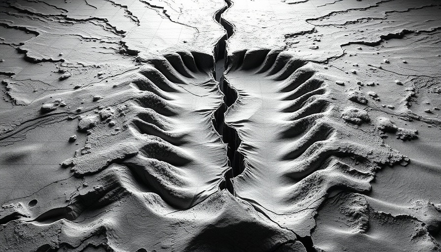
On March 28, 2025, a magnitude 7.7 earthquake rattled Myanmar, leaving behind destruction and awe. However, it was a seemingly simple CCTV recording that led to a groundbreaking revelation in earthquake science. Researchers Jesse Kearse and Yoshihiro Kaneko from Kyoto University discovered visual evidence of curved fault slip, a phenomenon that has eluded geologists for centuries. With this significant finding, scientists now have a clearer picture of how earthquakes rupture.
The Science Behind the Discovery
The real beauty of this discovery lies in the ability to visualize a theory that has existed for years. Kearse describes the moment he spotted the unexpected movement in the video: objects shifted not in a straight line but in a curved path, an indicator of complex geological behaviors occurring under stress. “It sent chills down my spine,” he remarked, encapsulating the thrill of witnessing something vital that had previously been represented only through indirect evidence.
Understanding Fault Movement
The concept of curved fault slip is not just theoretical; it is grounded in the very mechanics of how rocks shift and slide during quakes. In the past, geologists observed curved slickenlines – marks left by moving blocks of rock – but lacked direct visual proof of the movements causing these marks. This video footage allows researchers to measure the direction and rate of motion during such seismic events, ultimately enriching our understanding of fault dynamics.
Filling Gaps in Earthquake Research
This discovery is crucial for several reasons. Firstly, it challenges previous assumptions about fault behavior, which could lead to enhanced seismic models. Better models not only improve our understanding of earthquakes but can also potentially inform safety measures and preparedness strategies in earthquake-prone areas. In a world increasingly affected by geological hazards, these insights are invaluable.
The Bigger Picture: Implications for Urban Planning and Safety
Understanding nuanced geological behavior is especially critical in urban planning, particularly in rapidly developing cities. As places like Dallas evolve, integrating geological research into planning and building can help mitigate risks associated with seismic activity. For those living in Dallas or considering a move there, it’s essential to recognize both the unpredictable nature of earthquakes and the advances made in learning about them.
Comparing Urban Life: Living in Dallas vs. Other Cities
As interests shift toward safety in urban environments, those exploring living in Dallas may find the city’s infrastructure evolving in response to such discoveries. While the cost of living in Dallas is competitive compared to other major US cities, understanding geological risks can impact these considerations. According to current analyses, residents can expect varying costs while remaining mindful of the latent risks posed by unpredictable natural events.
Conclusion: A Call to Action for Urban Awareness
This astonishing finding serves as a reminder of the dynamic nature of our planet and the importance of continuous research. Urban dwellers, particularly in geologically active regions, must stay informed about the implications of geological studies. Enhancing knowledge about your urban environment can drive informed discussions about safety measures and emergency preparedness strategies. Explore more about your city’s geological history and how it impacts your community and lifestyle!


Write A Comment